File:AreaClosure.png
From energypedia
The printable version is no longer supported and may have rendering errors. Please update your browser bookmarks and please use the default browser print function instead.
No higher resolution available.
AreaClosure.png (530 × 278 pixels, file size: 130 KB, MIME type: image/png)
Summary
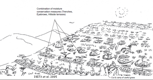
Agro-forestry, Forage Development and Forestry: Area closure. Source: DESTA, L. ET AL. (2005): Part 1: Community Based Participatory Watershed Development: A Guideline. Addis Ababa: Ministry of Agriculture and Rural Development.
== Licensing ==Template:License box template
File history
Click on a date/time to view the file as it appeared at that time.
| Date/Time | Thumbnail | Dimensions | User | Comment | |
|---|---|---|---|---|---|
| current | 07:10, 17 May 2011 | | 530 × 278 (130 KB) | ***** (***** | *****) | |
| 11:12, 25 April 2011 | 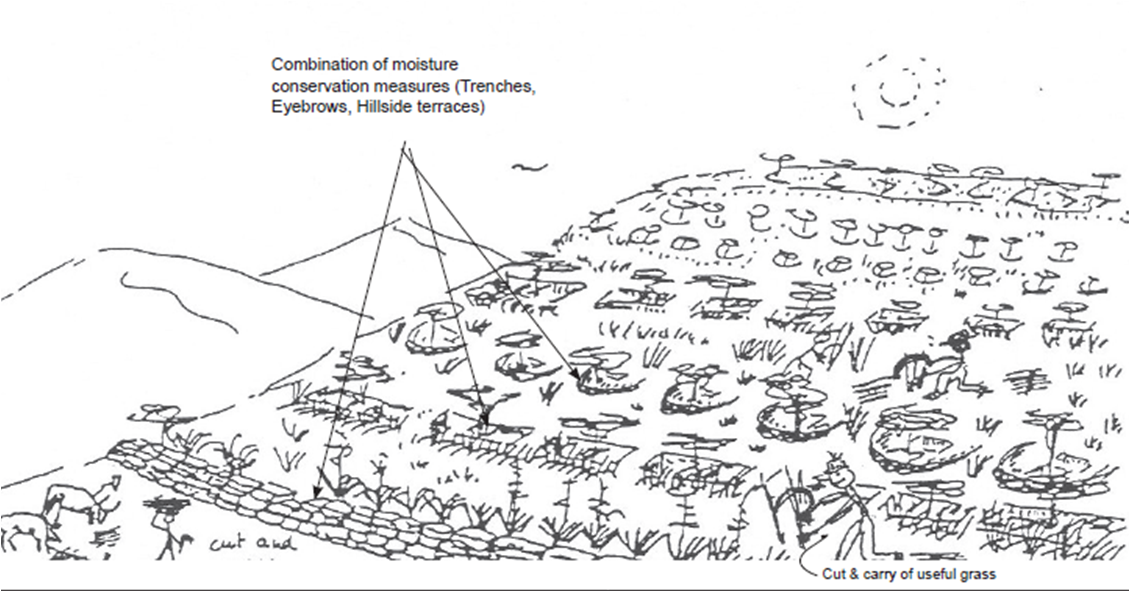 | 1,130 × 592 (487 KB) | ***** (***** | *****) | Agro-forestry, Forage Development and Forestry: Area closure. Source: DESTA, L. ET AL. (2005): Part 1: Community Based Participatory Watershed Development: A Guideline. Addis Ababa: Ministry of Agriculture and Rural Development. Category:Ethiopia [[C |
You cannot overwrite this file.
File usage
The following page uses this file:


