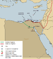
File:Egypt's Map.png
From energypedia
Revision as of 14:09, 22 July 2019 by ***** (***** | *****)
The printable version is no longer supported and may have rendering errors. Please update your browser bookmarks and please use the default browser print function instead.
Egypt's_Map.png (473 × 527 pixels, file size: 0 bytes, MIME type: image/png)
Summary
| Description |
English: Article's Graph
|
|---|---|
| Source |
https://www.eia.gov/beta/international/analysis_includes/countries_long/Egypt/egypt.pdf |
| Date |
2018-08-28 |
| Author |
EIA |
| Permission |
See license tag below. |
Licensing
| This file is licensed under the Creative CommonsAttribution-Share Alike 3.0 Unported license. | ||
|
File history
Click on a date/time to view the file as it appeared at that time.
| Date/Time | Thumbnail | Dimensions | User | Comment | |
|---|---|---|---|---|---|
| current | 13:56, 28 August 2018 |  | 473 × 527 (0 bytes) | ***** (***** | *****) | User created page with UploadWizard |
You cannot overwrite this file.
File usage
The following page uses this file:


