Difference between revisions of "File:Map Hagara Sodicha upstream.jpg"
From energypedia
***** (***** | *****) (GIS-based land use/land cover map of the upstream Hagara Sodicha catchment/Ethiopia. Source: K. Meder 2011. {{PAGENAME}} {{PAGENAME}}) |
(No difference)
|
Latest revision as of 12:58, 10 February 2012
Summary
GIS-based land use/land cover map of the upstream Hagara Sodicha catchment/Ethiopia. Source: K. Meder 2011.
Licensing
File history
Click on a date/time to view the file as it appeared at that time.
| Date/Time | Thumbnail | Dimensions | User | Comment | |
|---|---|---|---|---|---|
| current | 12:58, 10 February 2012 | 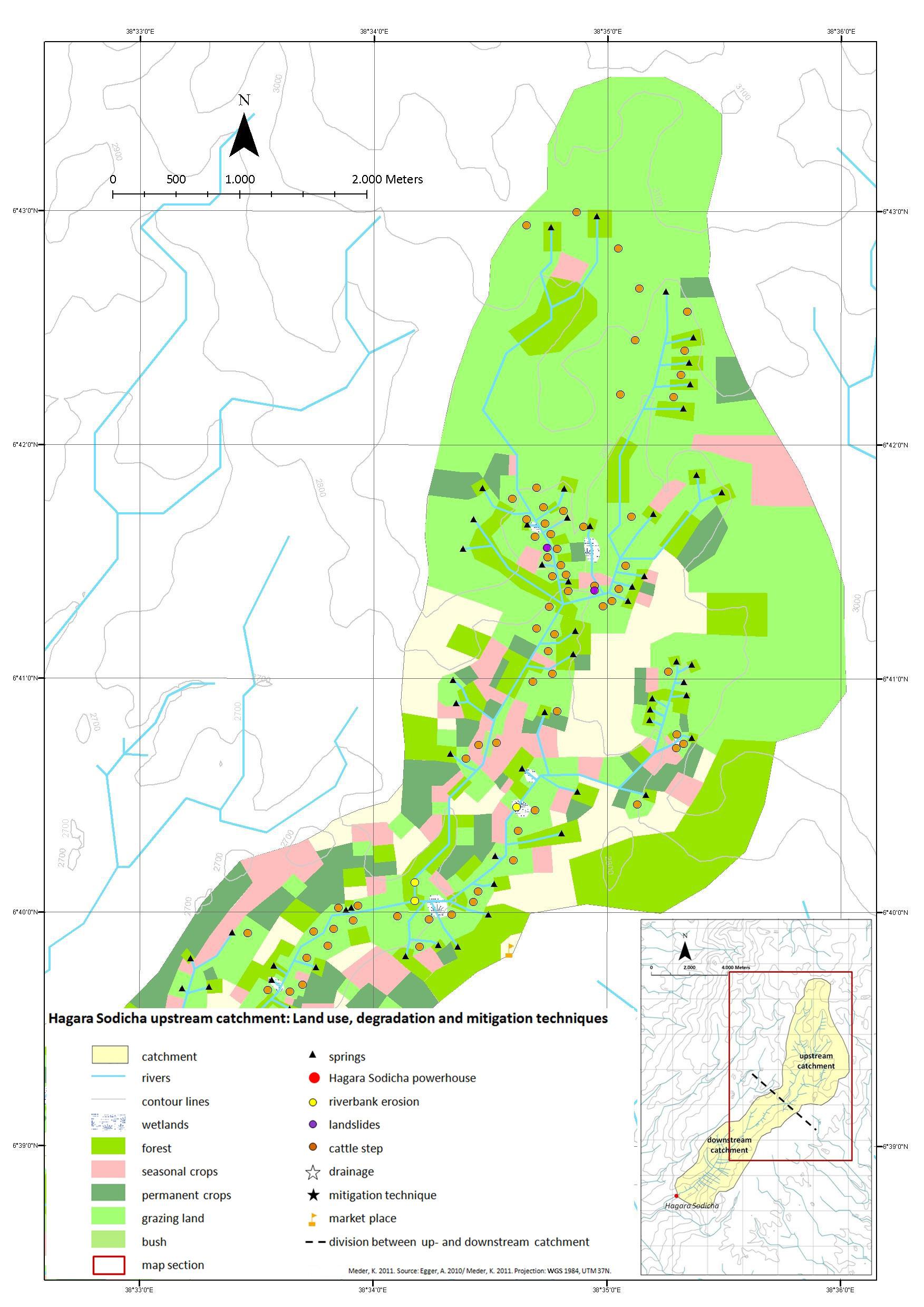 | 1,753 × 2,480 (393 KB) | ***** (***** | *****) | GIS-based land use/land cover map of the upstream Hagara Sodicha catchment/Ethiopia. Source: K. Meder 2011. {{PAGENAME}} {{PAGENAME}} |
You cannot overwrite this file.
File usage
There are no pages that use this file.


