File:Core geophysical parameters for suitability mapping.png
From energypedia
No higher resolution available.
Core_geophysical_parameters_for_suitability_mapping.png (282 × 241 pixels, file size: 0 bytes, MIME type: image/png)
Summary
| Description |
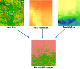
English: ToolKit Graph
|
|---|---|
| Source | |
| Date |
2018-08-30 |
| Author |
EED Advisory |
| Permission |
See license tag below. |
Licensing
{{subst:uwl}}
File history
Click on a date/time to view the file as it appeared at that time.
| Date/Time | Thumbnail | Dimensions | User | Comment | |
|---|---|---|---|---|---|
| current | 11:07, 30 August 2018 | | 282 × 241 (0 bytes) | ***** (***** | *****) | User created page with UploadWizard |
You cannot overwrite this file.
File usage
The following page uses this file:


