| Display title | File:Fig 3- Maps showing distribution of croplands in Makueni (top left) .png |
| Default sort key | Fig 3- Maps showing distribution of croplands in Makueni (top left) .png |
| Page length (in bytes) | 250 |
| Namespace | File |
| Page ID | 137839 |
| Page content language | en - English |
| Page content model | wikitext |
| Indexing by robots | Allowed |
| Number of redirects to this page | 0 |
| Hash value | 74793452caa69d5346bcb8a8e18a7cb79518c375 |
| Page image | 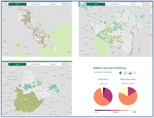 |
| Edit | Allow all users (infinite) |
| Move | Allow all users (infinite) |
| Upload | Allow all users (infinite) |
| Page creator | ***** (***** | *****) |
| Date of page creation | 13:18, 16 May 2023 |
| Latest editor | ***** (***** | *****) |
| Date of latest edit | 13:18, 16 May 2023 |
| Total number of edits | 1 |
| Total number of distinct authors | 1 |
| Recent number of edits (within past 90 days) | 0 |
| Recent number of distinct authors | 0 |
_.png)


_.png&hidelinks=1&hidetrans=1&hideimages=1)
_.png&oldid=409918)
_.png)
_.png&action=edit&redlink=1)
_.png&action=edit)
_.png&action=history)
_.png)
_.png)
_.png&action=info)
-5F.png)