Difference between revisions of "File:Watershed Deliniation Topographic Map.png"
From energypedia
***** (***** | *****) |
***** (***** | *****) |
||
| (One intermediate revision by the same user not shown) | |||
| Line 2: | Line 2: | ||
== Licensing == | == Licensing == | ||
| + | {{Template:License_box_template| | ||
| + | '''External file, license unclear.'''|This file is from an '''external source''', the '''usage rights are unclear'''. <br />Only for internal use.|}} | ||
| − | + | [[Category:License Template]] | |
| − | [[Category:Ethiopia]][[Category:Hydro]][[Category:Systemfile]] | + | [[Category:Ethiopia]] [[Category:Hydro]] [[Category:Systemfile]] [[Category:Copyright]] |
Latest revision as of 12:03, 22 August 2011
Example: Watershed Deliniation on a Topographic Map. Source: DESTA, L. ET AL. (2005): Part 2: Community Based Participatory Watershed Development: Annex. Addis Ababa: Ministry of Agriculture and Rural Development.
Licensing
File history
Click on a date/time to view the file as it appeared at that time.
| Date/Time | Thumbnail | Dimensions | User | Comment | |
|---|---|---|---|---|---|
| current | 08:47, 17 March 2011 | 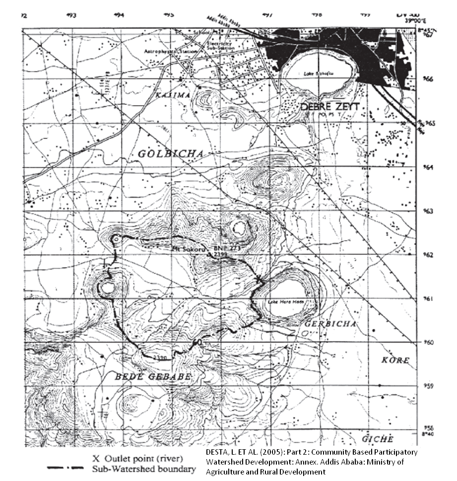 | 921 × 969 (839 KB) | ***** (***** | *****) | Example: Watershed Deliniation on a Topographic Map. Source: DESTA, L. ET AL. (2005): Part 2: Community Based Participatory Watershed Development: Annex. Addis Ababa: Ministry of Agriculture and Rural Development. Category:Ethiopia Category:Hydro |
You cannot overwrite this file.
File usage
The following page uses this file:


