File:Figure 9 Overview of the geospatial modelling.png
From energypedia
Size of this preview: 800 × 450 pixels. Other resolutions: 320 × 180 pixels | 1,280 × 720 pixels.
Original file (1,280 × 720 pixels, file size: 0 bytes, MIME type: image/png)
Summary
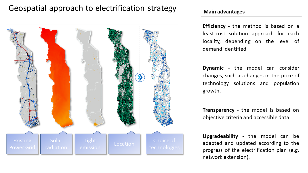
| Description |
English: Overview of the geospatial modelling based on digital cartography to show the possibilities for technical implementation (SET, 2018)
|
|---|---|
| Source |
Own Work |
| Date |
2020-05-28 |
| Author | |
| Permission |
See license tag below. |
Licensing
|
File history
Click on a date/time to view the file as it appeared at that time.
| Date/Time | Thumbnail | Dimensions | User | Comment | |
|---|---|---|---|---|---|
| current | 07:33, 28 May 2020 | | 1,280 × 720 (0 bytes) | ***** (***** | *****) | User created page with UploadWizard |
You cannot overwrite this file.
File usage
The following page uses this file:


