File:Fig 4- Maps showing distribution of agro-processing facilities (red symbols).png
From energypedia

Size of this preview: 703 × 599 pixels. Other resolutions: 282 × 240 pixels | 806 × 687 pixels.
Original file (806 × 687 pixels, file size: 393 KB, MIME type: image/png)
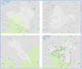
Fig 4: Maps showing distribution of agro-processing facilities (red symbols) in Narok (top left), Bungoma (top right) and Makueni Counties (bottom left) with the comparison of the locations of agro-processing facilities and croplands for Narok also shown (bottom right)
File history
Click on a date/time to view the file as it appeared at that time.
| Date/Time | Thumbnail | Dimensions | User | Comment | |
|---|---|---|---|---|---|
| current | 13:29, 16 May 2023 |  | 806 × 687 (393 KB) | ***** (***** | *****) |
You cannot overwrite this file.


